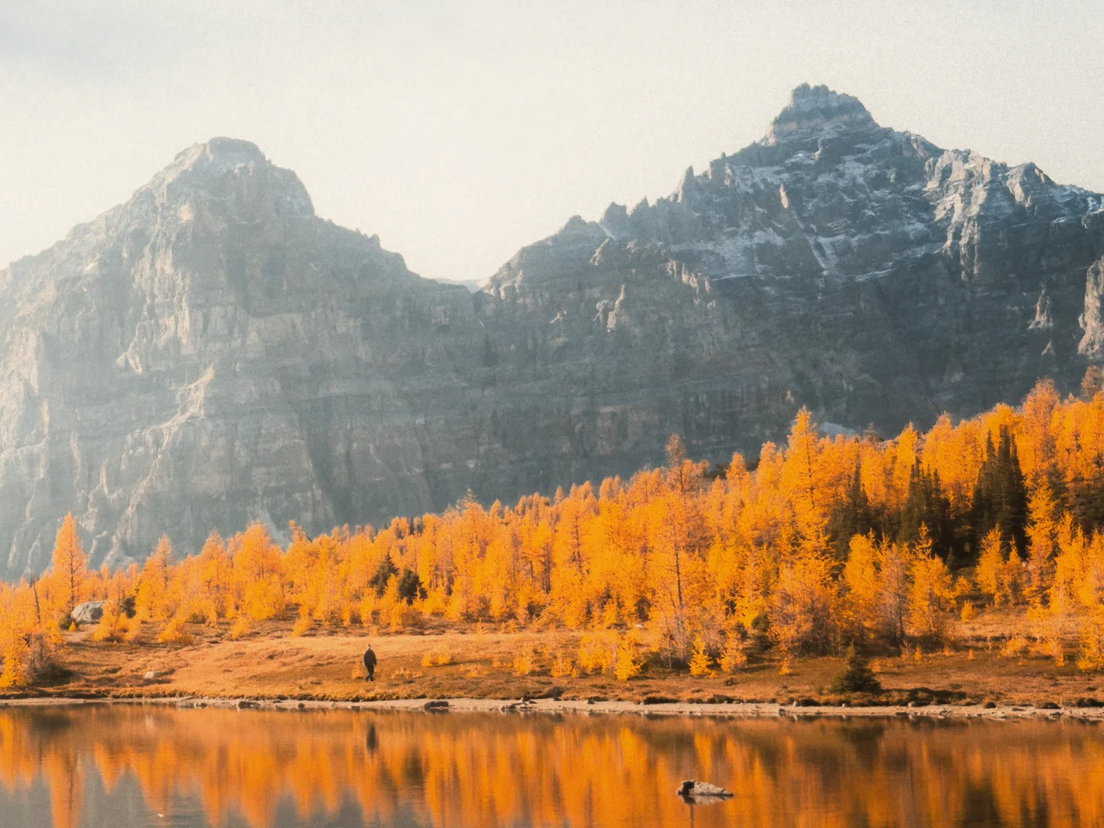
Larch colour, trail conditions, restrictions, weather, parking, and lake transport can change independently. Check the exact trail and access plan before leaving.
重点
The best trail is the one that fits the whole day.
The golden window is short, usually somewhere between mid-to-late September and early October. Trailhead access, weather, conditions, and the least experienced hiker matter more than chasing one supposedly perfect date.
最简单的安排If Larch Valley is the dream, make the Moraine Lake ride real first. After that, the hike, weather check, and Plan B become much simpler.
01
先读这里
The short version
Banff's larches put on a brief golden show, usually from mid-to-late September into early October. Weather decides the exact timing, so no date is a peak-colour guarantee.
For the classic day, compare Larch Valley and Eiffel Lake at Moraine Lake with Saddleback Pass at Lake Louise. For a longer outing, look at Twin Lakes, Healy Pass, or Rockbound Lake. Sunshine Meadows offers a lift-assisted alternative when seasonal access works.
Two options reach beyond Banff: Pocaterra Ridge is an undesignated route in Kananaskis, while Lake O’Hara’s Lake McArthur circuit is in Yoho, B.C. They need different access plans, not just a longer drive added to the same itinerary.
On the morning of the hike, check the responsible park’s trail conditions, bulletins, restrictions, and the forecast: Parks Canada for Banff and Yoho, Alberta Parks for Kananaskis. Snow, ice, wildlife activity, or a transport change can make yesterday's plan the wrong one today.
A useful Plan B sits lower, asks less of the group, and is still worth doing without golden larches. If the alpine day has gone sideways, there is no prize for forcing another high pass.
Details can change quickly — check before going.
Park admission/pass status: National park admission for Banff or Yoho is separate from parking, shuttles, and tours unless explicitly included. Pocaterra is in Kananaskis, where the applicable vehicle conservation pass is a different product. Check the current rule for your exact destination and date.
Location parking fees: Moraine Lake has no personal-vehicle parking. Lake Louise has separate paid-parking and transit decisions that can change by season and demand. Confirm the trailhead plan before travel.
Transit/shuttle reservations: Moraine Lake, Lake Louise, Sunshine Meadows lifts, and Lake O’Hara have separate access products, operating dates, and return cutoffs. A trail plan does not guarantee a seat, parking space, or same-day access.
These are choices, not a ranking. Compare the exact route, region, effort, and way home. Distances below are route-specific; walking times are estimates, not daylight or transport guarantees.
ClassicClassic choice
Larch Valley / Minnestimma Lakes
The classic one: steady forest switchbacks that open into a gold-filled valley beneath the Ten Peaks.
Effort · Moderate
Best for
Visitors who want the classic route and can manage 570 m of climbing.
Skip if
Moraine access is unresolved or the climb is beyond the group's ability.
Booking
Reserve Moraine Lake access before building the day
Parks Canada lists 4.5 km one way, 570 m of gain, and 3.5 to 4 hours return.
Take transit to Moraine Lake and start beyond Moraine Lake Lodge.
Sentinel Pass is a separate, harder extension; it is not part of the default Larch Valley plan.
Longer Moraine optionLonger views
Eiffel Lake
It shares Larch Valley's opening climb, then peels onto a quieter traverse along the Valley of the Ten Peaks.
Effort · Moderate
Best for
Stronger hikers who want a longer trail from the same transit-only trailhead.
Skip if
You want the shortest classic larch outing or have a tight return window.
Booking
Uses the same Moraine Lake access decision
Parks Canada lists 5.7 km one way, 560 m of gain, and 4 to 5 hours return.
The trail splits from Larch Valley and begins beyond Moraine Lake Lodge.
Confirm the exact trail and transport return time before choosing it over Larch Valley.
Lake Louise startNo Moraine start
Saddleback Pass
Shorter on paper, steeper underfoot, and based at Lake Louise instead of Moraine.
Effort · Demanding
Best for
Experienced hikers who prefer a Lake Louise trailhead and can manage a steep climb.
Skip if
A difficult 600 m climb is not right for the least experienced person in the group.
Booking
Resolve Lake Louise parking or transit first
Parks Canada lists 3.6 km one way, 600 m of gain, and 3 to 4 hours return.
It starts at Lake Louise Lakeshore and is rated difficult by Parks Canada.
Paid parking and transit are separate from Moraine Lake access; use the Lake Louise parking guide.
Banff · Vista Lake trailheadFull-day lakes
Twin Lakes via Vista Lake and Arnica Lake
A larch-lined climb to Arnica leads over a ridge to Upper Twin, then down to Lower Twin. The repeated climbs matter as much as the destination.
Effort · Demanding
Best for
Fit hikers who want several lakes and can leave enough energy for the return climbs.
Skip if
You need a short walk, or have only budgeted effort for the outward journey.
For Lower Twin Lake via this route, Parks Canada lists 7.4 km one way (14.8 km return), 700 m gain and 295 m loss, with 6 to 7 hours return. Those figures are not for stopping at Arnica or Upper Twin.
Start at the Vista Lake viewpoint on Highway 93 South. Use the designated parking area; roadside parking is not an overflow plan.
Decide the turnaround lake before leaving. Dropping to Lower Twin commits you to climbing back out; check the exact route’s conditions and wildlife bulletins.
Banff · Sunshine Village parkingLong meadow day
Healy Pass
A long approach beside Healy Creek opens into alpine meadows and scattered larches. Give it a full day, not a spare afternoon.
Effort · Demanding
Best for
Prepared hikers who prefer a walking approach to the high meadows.
Skip if
Your group cannot comfortably manage a long return hike or the forecast threatens the alpine section.
Parks Canada lists 8.8 km one way (17.6 km return), 655 m gain, and 6 to 7 hours return.
The trail starts behind the main gondola building at Sunshine Village parking. This walking route does not need a gondola ticket.
Stay on designated trails and check current Parks Canada restrictions. Roots, rocks, mud, and early snow can change the pace; the meadows are not a shortcut to Sunshine’s lifts.
Banff · seasonal lift accessLift-assisted option
Sunshine Meadows
A flexible alpine-meadow day when the gondola and chairlift are operating. Choose the actual trail loop, not a generic distance for the whole area.
Effort · Some planning
Best for
Visitors seeking a shorter maintained meadow walk with seasonal lift assistance.
Skip if
Lifts are closed, visibility is poor, or your selected route exceeds the group’s ability.
Booking
Check operating dates and the last lift down
Rock Isle Lake and the Standish viewpoint are useful starting points on the operator’s trail map. Distance and climbing depend on your loop and which lifts operate.
Lift access reduces the approach, not the altitude or exposure. Check tickets, hours, current Parks Canada conditions, and designated-trail restrictions separately.
A sunset photography plan must fit the confirmed last descent. Do not substitute a long walk down for a missed lift in your default plan.
Banff · Castle Junction areaStrenuous lake day
Rockbound Lake
A steady forest climb passes Tower Lake before reaching the high basin beneath Castle Mountain. September larches are a reason to go, not a reason to rush the return.
Effort · Demanding
Best for
Fit hikers comfortable with a long, rooty and rocky approach to an alpine lake.
Skip if
You want a quick viewpoint, or current snow, debris, or wet conditions exceed your ability.
Parks Canada lists 8.5 km one way (17 km return), 765 m gain, and 6 to 7 hours return.
Start at Rockbound Lake parking just east of Castle Junction on the Bow Valley Parkway. Check the exact road section as well as the trail before driving.
Tower Lake is on the approach; reaching it is not the same as reaching Rockbound. Recheck trail reports for debris, mud, and snow before choosing this full-day route.
Kananaskis · outside Banff National ParkUndesignated route
Pocaterra Ridge
An advanced larch-season option that needs a precise route plan. The ridge, cirque, and maintained Pocaterra trail are not interchangeable names.
Effort · Demanding
Best for
Experienced hikers who can navigate an unmaintained route and verify the exact start, finish, and return logistics.
Skip if
You need a maintained, consistently signed beginner route or have not settled the route variant.
Alberta Parks distinguishes its designated Pocaterra trail from the undesignated Pocaterra Ridge and Cirque routes. Do not borrow the maintained trail’s distance or condition report for the ridge.
No single distance is given here: a ridge traverse, shorter out-and-back, and cirque visit are different outings. Confirm your route using a suitable map, current advisories, and on-site signage.
Check Highwood-area access and the applicable Kananaskis Conservation Pass for parked vehicles. Set the return logistics before leaving; a national park pass does not cover this separate requirement.
Yoho, B.C. · reserved accessPlan access first
Lake O’Hara: Lake McArthur and Big Larch Trail
Lake O’Hara is a network, not one hike. The Lake McArthur circuit gives this choice a specific route through larch forest and along Big Larch Trail.
Effort · Moderate
Best for
Prepared hikers with confirmed access who want a distinct Yoho larch outing.
Skip if
You are treating a missing shuttle booking as a minor detail or expecting an easy roadside lake.
Booking
Confirm the Lake O’Hara reservation and return bus
Parks Canada lists the Lake McArthur circuit as 8 km with 310 m gain from the Lake O’Hara area. This does not include the access road.
The circuit climbs through larch forest and returns along Big Larch Trail. Check the precise route’s snow, ice, and closure conditions; the wider alpine network is not one difficulty level.
The reserved shuttle is seasonal. Walking the access road adds 11 km each way (22 km return) before your chosen hike, and cycling is prohibited. Do not assume a walk-in guarantees a bus seat out.
03
Timing uncertainty
How the short colour window usually moves
These are planning ranges, not a forecast. Weather and elevation decide the actual colour.
Before mid-September
Usually too early to plan for full gold
Use the day for hiking, not a colour guarantee. Trees and elevations change at different rates.
Mid-to-late September
The usual transition begins
Colour often starts in this period, but warm weather can delay it and early snow can change the hike.
Late September into early October
The usual target window
This is the common planning window, not a peak-date promise. Keep dates and routes flexible.
After early October
Colour and access become less reliable
Do not assume larches, trail conditions, or seasonal transport still line up. Check each one.
04
What makes the day work
Trailheads, weather, light and the way home
The trailhead is half the plan
Larch Valley and Eiffel Lake both begin at Moraine Lake, and personal vehicles cannot drive there. The ride in is not a footnote; it sets the arrival time, return window, and shape of the day.
Saddleback begins at Lake Louise. Its parking and transit choices are separate from Moraine Lake, even though the two trailheads appear close together on a regional map.
Twin Lakes starts at the Vista Lake viewpoint on Highway 93 South. Healy Pass starts behind the gondola building at Sunshine Village parking; it does not require a lift ride. Rockbound Lake starts just east of Castle Junction on the Bow Valley Parkway. Use designated parking, never the highway shoulder.
Sunshine Meadows lift access is seasonal: check the operator’s operating dates, last descent, and trail map before choosing a loop. Healy Pass and the Sunshine Meadows area also have designated-trail restrictions; check the current bulletin and stay on official trails.
Lake O’Hara is in Yoho National Park. Its reserved day shuttle and the hike are separate decisions. Walking the 11 km access road each way adds 22 km before any lakeside trail; cycling the road is prohibited. A walk-in is not a casual substitute for a missing bus reservation.
Pocaterra is in Kananaskis, outside Banff National Park. Check current Alberta Parks advisories and trailhead signage, confirm the exact ridge variant and return logistics, and arrange the applicable Kananaskis Conservation Pass for parked vehicles. A national park pass does not replace it.
The dedicated Moraine access and Lake Louise parking guides carry the current fares, products, and reservation details. This page keeps the trail choice readable instead of repeating a second transport guide inside it.
Park admission, parking, and a shuttle or tour seat are separate unless an operator clearly says otherwise.
Let the mountain have the final say
Before leaving, open the Parks Canada Banff trail-conditions page and important bulletins for Banff hikes. Switch to Yoho for Lake O’Hara or Alberta Parks for Pocaterra. Check the exact trail, not just the region or yesterday's report.
Stay on designated trails. Carry layers, food, water, a headlamp, and bear spray, and know how to use what you bring. Choose a hike suitable for the least experienced person in the group.
A trail rating copied into a future itinerary is not a conditions report. Closures, wildlife restrictions, snow, and ice can all change after this guide is reviewed.
Work backwards from the confirmed return transport, remaining daylight, weather, and group pace. No photo is worth missing the last ride or walking deeper into worsening conditions.
Cody's field notes: chase the light, keep the exit easy
Personal field note, not a forecast: late September is where Cody starts looking, but he has also watched one storm strip the colour surprisingly quickly. That is lived experience, not a promise about this year's peak.
Early and late light usually gives the gold more shape. A 3–4 a.m. start can make sense for a specific shoot, but it is not a general recommendation and may be impossible where trailhead access is controlled.
Cody uses Windy to picture wind and precipitation trends beside the official Weather Canada forecast, then checks Parks Canada conditions, bulletins, and access separately. Windy is a planning aid, not the authority for closures, warnings, trail status, or transport.
The light can change faster than the plan. Make the photographic decisions early, carry a headlamp and proper layers, then leave enough margin to turn around without drama.
A good Plan B is still a good Banff day
If the alpine route no longer feels right, make the day genuinely easier instead of carrying the same ambition to another pass.
Lake Louise Lakeshore can work as a shorter fallback once its access and conditions are rechecked. It is a good lake walk, not a replacement promise for a golden-larch hike.
A Banff-town walk, museum, or short viewpoint can rescue the day when the lake corridor stops making sense. The planner and current conditions page can rebuild around what is actually workable.
A relaxed mountain day without peak colour beats a forced hike built around somebody's calendar guess.
05
Where plans wobble
Five ways a larch day gets harder than it needs to
这些问题在游客提问里反复出现。提前看一眼,就很容易避开。
✗
Chasing one predicted peak day.
The usual colour window is weather-dependent. Keep two possible hiking days or accept that the trip may be scenic without full gold.
✗
Booking the hike but not the trailhead.
A Larch Valley plan is incomplete without Moraine Lake access; a Saddleback plan needs its own Lake Louise parking or transit decision.
✗
Using popularity as a difficulty rating.
Larch Valley still gains 570 m, and Parks Canada rates Saddleback as difficult. Choose for the least experienced person in the group.
✗
Treating last night's conditions as current.
Recheck Parks Canada conditions, bulletins, weather, snow, and wildlife restrictions on the morning of the hike.
✗
Making the backup another exposed pass.
A useful fallback lowers elevation, access friction, and effort. It should still feel like a good day without golden larches.
06
Before you leave
Seven things worth checking over breakfast
已勾选 0 / 7 项
常见问题
游客常问
When is larch season in Banff?
The golden-larch window is short and weather-dependent. It generally begins in mid-to-late September and can extend into early October, with the usual target around late September; no date guarantees peak colour.
Is Larch Valley suitable for a first-time Banff hike?
It can fit a prepared first-time visitor with suitable fitness, but it is not an easy stroll. Parks Canada lists 4.5 km one way, 570 m of gain, and 3.5 to 4 hours return; choose for the least experienced person in the group.
Can I drive to Larch Valley?
No. Larch Valley starts at Moraine Lake, and Moraine Lake Road is closed to personal motor vehicles year-round. Confirm a current shuttle, transit, licensed operator, cycling, or hiking access plan before the day.
What should I do if Larch Valley conditions or access change?
Do not force another exposed alpine route. Recheck Parks Canada conditions and bulletins, then downshift to a lower-elevation plan such as Lake Louise Lakeshore only if its access and conditions also work, or rebuild a Banff-town day.
Which Banff larch hike should I choose if Moraine Lake does not fit my day?
Saddleback Pass starts at Lake Louise; Twin Lakes, Healy Pass, and Rockbound Lake have other Banff trailheads and require full-day fitness. Sunshine Meadows can reduce the approach when seasonal lifts operate. None is an automatic bad-weather substitute for Larch Valley.
How long is the Twin Lakes hike in Banff?
For Lower Twin Lake via Vista Lake and Arnica Lake, Parks Canada lists 7.4 km one way, or 14.8 km return, with 700 m gain and 295 m loss and an estimated 6 to 7 hours return. Upper Twin and Arnica are different turnaround points; repeated climbs matter on the way back.
Do I need a gondola ticket to hike Healy Pass?
No lift ride is needed for the Healy Pass trail from Sunshine Village parking. The trail starts behind the main gondola building and is 17.6 km return with 655 m gain. Sunshine Meadows lift-assisted loops are a separate outing with seasonal operating hours and tickets.
Are Pocaterra Ridge and Lake O’Hara in Banff National Park?
No. Pocaterra Ridge is in Kananaskis, where the applicable vehicle conservation pass is separate from national park admission. Lake O’Hara is in Yoho National Park, B.C., and needs its own access plan. The 8 km Lake McArthur circuit does not include the 22 km return access-road walk if you lack a shuttle booking.